
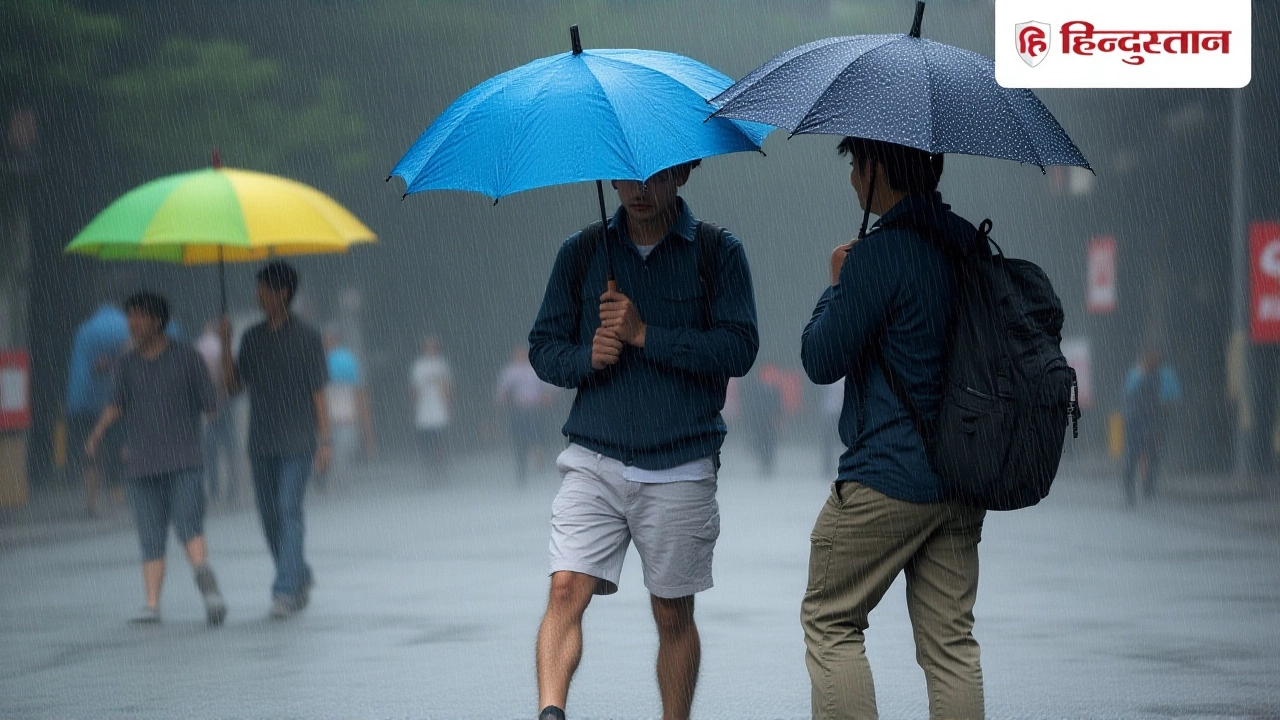
Heavy rain, squally winds, and a brewing depression over the Bay of Bengal are set to disrupt life across southern India through the end of November 2025, the India Meteorological Department warned in a series of bulletins issued between November 20 and 24. The alert isn’t just for fishermen or coastal communities—it’s for tourists on ferries, residents of high-rises in Kochi, and even schoolchildren in Chennai whose outdoor activities could be canceled for days. The system, which began as a low-pressure area over the Strait of Malacca and South Andaman Sea on November 23, is expected to intensify into a depression by November 24 before moving west-northwest toward the southwest Bay of Bengal. And the impact? It’s already being felt.
Storm Brewing Over the Bay
The India Meteorological Department’s CFS V-2 model showed a 60-70% probability of cyclogenesis forming in the central south Bay of Bengal during the first week of December’s precursor period. By November 23, the system had already triggered very heavy rainfall across the Andaman & Nicobar Islands, with wind gusts hitting 75 kmph in some areas. The IMD’s forecast for November 23-24 specified that the islands would see “very heavy rainfall,” with “squally weather” continuing until November 25. That’s not just inconvenient—it’s dangerous for small vessels and low-lying coastal zones.Meanwhile, Kerala was bracing for a different kind of deluge. According to the IMD Thiruvananthapuram forecast dated November 20, “Fairly Widespread Light to Moderate Rainfall with Isolated Heavy Rainfall accompanied with thunderstorm and lightning” was expected on November 22 and 23. By the 24th, it eased to scattered showers, and by the 25th and 26th, only isolated light rain. The pattern was clear: a sharp peak, then a rapid decline.
Temperature Drops and Regional Disparities
While the south drowned, the north cooled. The IMD noted that minimum temperatures across Jammu-Kashmir-Ladakh-Gilgit-Baltistan-Muzaffarabad would plunge below 6°C—freezing conditions in places where winter tourism is already peaking. In Punjab, temperatures hovered between 7-10°C, while travelers to Jaipur, Shimla, and Rishikesh could expect days that felt crisp and pleasant, but nights that required heavy jackets. A 2-4°C drop over the week was forecasted across northern states, with no major changes expected in northwest India’s plains until late November.And then there’s the fog. Shallow to moderate fog blanketed northeast India—from Assam to Nagaland—making early morning commutes hazardous. In isolated pockets of West Madhya Pradesh, a cold wave on November 22-23 disrupted morning traffic but, as the IMD noted, posed “no major disruptions.” That’s the understatement of the season.
Who’s Affected and How
The IMD didn’t just issue warnings—it spelled out consequences. “The weather systems will have direct implications not just for fishermen but also for tourists onboard private yachts, ferries, and cruise vessels,” said the Times of India report, citing IMD officials. That means cruise lines docking in Kochi or Cochin may face delays. Ferry operators between the mainland and the Andaman & Nicobar Islands were advised to suspend operations. Even local markets in Thiruvananthapuram reported early stockpiling of essentials as residents braced for power outages and flooded streets.Meanwhile, Kerala’s agricultural sector—already reeling from erratic monsoons—faced a mixed bag. While rainfall was below normal for the cumulative period, the intense bursts on the 22nd and 23rd could damage banana and tapioca crops. “It’s not the amount, it’s the timing,” said Dr. Latha Menon, a senior agronomist with the Kerala Agricultural University. “Heavy rain during flowering stages can ruin yields overnight.”
The Turning Point: Late November to Early December
Here’s the relief: after November 25, the system weakens. The depression is forecasted to lose intensity as it moves inland, and rainfall over southern coastal states will taper off. By December 1, 2025, Kerala is expected to see “broken clouds,” temperatures between 24°C and 30°C, and a 0% rain risk. December 2 follows suit, with just a 10% chance of rain. That’s not just a forecast—it’s a return to normalcy.The transition isn’t just weather—it’s economic. The IMD’s extended forecast, issued from its headquarters at Mausam Bhawan, Lodhi Road, New Delhi, suggests a stable window opens for tourism, maritime trade, and power grid management. Airlines are already adjusting schedules. The Kerala Tourism Department quietly issued a “travel advisory” on November 23, urging visitors to postpone non-essential trips until December 1.
Who’s Calling the Shots?
Behind these forecasts are the scientists at the India Meteorological Department, led by its Director General, Dr. Mrutyunjay Mohapatra, and supported by forecasting specialists Dr. Naresh Kumar and Dr. Akhil Srivastava. Their team uses the CFS V-2 model, satellite data from INSAT-3DR, and ground-level sensors across 1,500 stations to piece together what’s coming. They don’t guess—they calculate. And when they say “60-70% probability,” they mean it.Frequently Asked Questions
How will this affect tourism in Kerala and the Andamans?
Tourism in Kerala and the Andaman & Nicobar Islands will be severely disrupted from November 22-25, with ferry cancellations, flight delays, and beach closures. Resorts are offering free cancellations through November 26. By December 1, conditions are expected to return to normal with 0% rain risk and comfortable temperatures—making it an ideal time to reschedule trips.
What’s the risk of flooding in coastal cities like Kochi and Chennai?
Kochi and other low-lying areas in Kerala face moderate to high flood risk during peak rainfall on November 22-23, especially in neighborhoods near backwaters and rivers. Chennai’s drainage system, improved since 2015, can handle moderate rainfall, but isolated heavy downpours could still cause localized waterlogging. The IMD has issued no major flood warnings yet, but emergency teams are on standby.
Why is rainfall below normal for Kerala despite the heavy downpours?
While the November 22-23 period brought intense rain, the overall cumulative rainfall for the month is still below normal because of dry spells earlier in November. The IMD defines “below normal” as 10-20% less than the 30-year average. This pattern—short, violent bursts followed by dry spells—is becoming more common with climate variability.
What does the 60-70% cyclogenesis probability mean?
It means, based on historical data and current atmospheric conditions, there’s a 6 in 10 to 7 in 10 chance that a low-pressure system will develop into a depression capable of sustaining winds over 55 kmph. This isn’t a guarantee—but it’s high enough for the IMD to issue urgent advisories. Similar probabilities preceded Cyclone Ockhi in 2017 and Cyclone Burevi in 2020.
Are there any travel advisories for tourists heading to North India?
Yes. While the south deals with rain, northern destinations like Shimla, Mussoorie, and Rishikesh are seeing colder nights (as low as 6°C) and early morning fog, especially in valleys. Travelers are advised to carry warm clothing and allow extra time for travel due to reduced visibility. No road closures are expected, but mountain routes may have icy patches.
When will normal weather return across India?
By December 1, 2025, southern India—including Kerala, Tamil Nadu, and Lakshadweep—is expected to transition to stable, dry conditions with broken clouds and no significant rainfall. The Bay of Bengal system will have fully dissipated. Northern India will continue cooling gradually, but no major storms are predicted. The next two weeks are forecasted to be among the most predictable since October.